Home
United States, Northeast Map
Loading Inventory...
Barnes and Noble
United States, Northeast Map
Current price: $14.95


Barnes and Noble
United States, Northeast Map
Current price: $14.95
Loading Inventory...
Size: OS
*Product Information may vary - to confirm product availability, pricing, and additional information please contact Barnes and Noble
• Waterproof • Tear-Resistant • Travel Map
There are few nations as vast and spectacularly diverse as the United States of America. From the Atlantic to the Pacific, "America the Beautiful" offers boundless destinations and experiences for travelers seeking outdoor adventures, small town delights, or the excitement of urban culture.
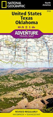
The United States Northeast Adventure Map will guide you through the states of the Mid Atlantic region (Virginia, West Virginia, Maryland, Delaware and Pennsylvania, New York and New Jersey) and New England (Connecticut, Rhode Island, Massachusetts, Vermont, New Hampshire, and Maine). Each of these states is rich in history and nature and has its own distinct character, from the dramatic rocky shoreline of Maine's Acadia National Park and the beaches and dunes of Cape Cod Massachusetts, through the Adirondack Mountains of New York, the White and Green Mountains of New Hampshire and Vermont, and the rolling Allegheny and Pocono Mountains of Pennsylvania. The diverse megalopolis of Washington DC, Philadelphia, New York City, and Boston that covers the Atlantic coastal plain is interspersed with historic seaports and beautiful parks, beaches, marshes, and bays including Chesapeake and Delaware Bays. The inland cities of Pittsburgh, Syracuse and Albany are also included on this map. There is simply no better map for exploring the Northeast United States.
National Geographic's US Adventure Maps provide the most authoritative and convenient travel maps available to plan and guide your USA Adventure. Each map delivers the perfect combination of detail and perspective, highlighting travel routes, topography, and points of interest for those venturing beyond the city centers. Whether you're on a classic American road trip or planning a grand tour to visit several cities or national parks, these maps offer the ultimate geographic resource as only National Geographic can provide.
Every Adventure Map is printed on durable synthetic paper, making them waterproof, tear-resistant and tough — capable of withstanding the rigors of international travel.
Map Scale = 1:1,300,000
Sheet Size = 25.5" x 37.75"
Folded Size = 4.25" x 9.25"

